
District Map
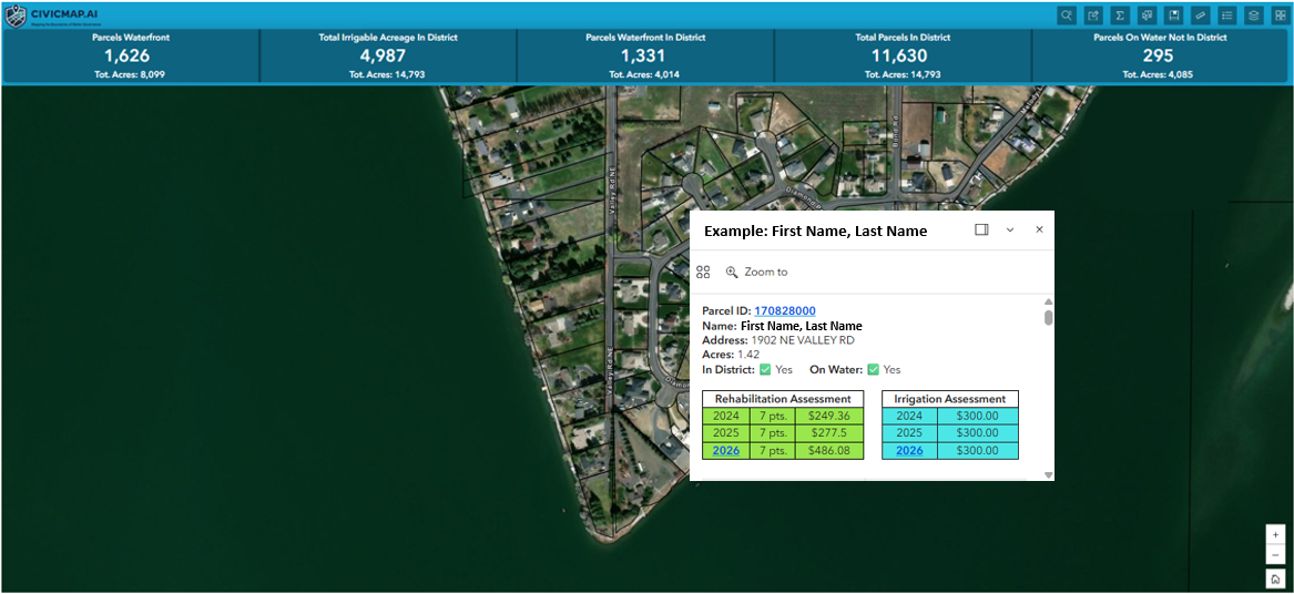
An address-aware public map embedded directly on the district website. Residents type an address; it answers in or out, what zone, what line, near what project.
Staff can log into the same map to update boundaries, projects, and notices — without sending data files back and forth.
Lives where residents already look. Embedded inside CivicPlus or Streamline. Branded as the district, not as us.